"Welcome to Crest of a Star; these maps and other graphics are only for playing D&D type games. They are copyright and not to be used for other purposes. If you have them on your site, please remove them. Thank you."

"My maps are free. If you purchased them, you got scammed."
"Not for redistribution or resale. Hyperlinking from Pinterest or other such share sites is prohibited."


large map to small map section, part 6

Posted

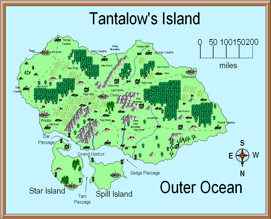
Final PNG picture and map file

I placed some of the symbols next to the edge of the map to show locations and give a three-dimensional aspect to it. Or you could draw a partial town, city, castle, etc. for the map edges if you need to mark a location.

I could have zoomed in, and got not only a smaller part of the large map, but a smaller scale as well as showing more local detail.

The method is essentially the same, but the symbols would have to be changed in scale.
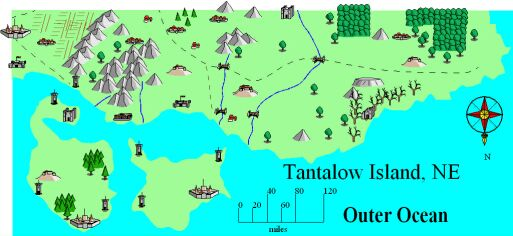
Tantalow's Island

Original picture and map

Tantalow's Island

Thats all of this tutorial. I hope it helped.


Author
Categories General, map tutorials


Privacy policy: I track IP addresses and pages looked at out of a vague curiosity to learn what pages are looked at on my site. After a set period, this information is deleted. No personal information is permanently kept.


[ Copyright © by Jim, 1980-2050. All Rights Reserved. ]

[ Except where noted, and where copyrights are held by others. ]