"Welcome to Crest of a Star; these maps and other graphics are only for playing D&D type games. They are copyright and not to be used for other purposes. If you have them on your site, please remove them. Thank you."

"My maps are free. If you purchased them, you got scammed."
"Not for redistribution or resale. Hyperlinking from Pinterest or other such share sites is prohibited."


Northern Islands Group entrance page

Posted

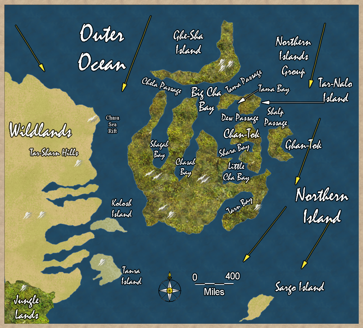
Trillolara and Dank Forest are off to the southwest of this map, over 3,500 miles away. The inhabitants of these islands have never heard of them.

Trillolara and Dank Forest are off the the southwest.

Each map square is 200 × 200 miles. North is at the top of the map. The yellow arrows are warm ocean currents from the tropics.

Updated map on March 22, 2020.


Author
Categories Outer Ocean, Northern Island


Privacy policy: I track IP addresses and pages looked at out of a vague curiosity to learn what pages are looked at on my site. After a set period, this information is deleted. No personal information is permanently kept.


[ Copyright © by Jim, 1980-2050. All Rights Reserved. ]

[ Except where noted, and where copyrights are held by others. ]