Zor continent Links
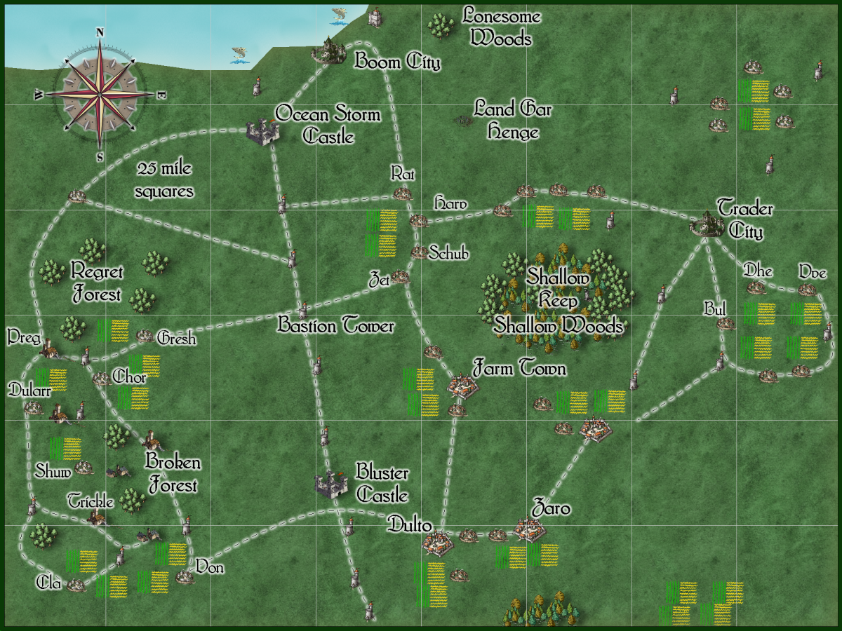
This a 200 mile x 150 mile part of The Narrows. It is part of Bar-Ara Land on the continent Zor.
Boom City and Trader city are new rivals to Big Trade city on the Ocean Bay side of this land.

"Welcome to Crest of a Star; these maps and other graphics are only for playing D&D type games. They are copyright and not to be used for other purposes. If you have them on your site, please remove them. Thank you."
Hi and welcome to my Crest of a Star site ! This site is my first edition AD&D materials.
I have added to the maps, people, etc. since I bought Campaign Cartographer 2 around 23 or so years ago. I now have CC3+ and all of its add-ons.
Link in the Home text at the top of this drop down will bring you back to the front page of this site.
My other rpg sites below.
Posted
This a 200 mile x 150 mile part of The Narrows. It is part of Bar-Ara Land on the continent Zor.
Boom City and Trader city are new rivals to Big Trade city on the Ocean Bay side of this land.

Author
Bill George
Categories
Bar-Ara Land, The Narrows
Posted
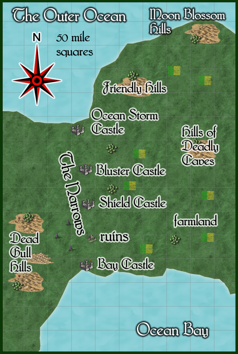
The farmland and ruins are generalized areas, not exact locations on this large map.
Map is 500 miles x 745 miles.

Author
Bill George
Categories
Bar-Ara Land, The Narrows
Posted

Author
Bill George
Categories
Outer Ocean
Posted
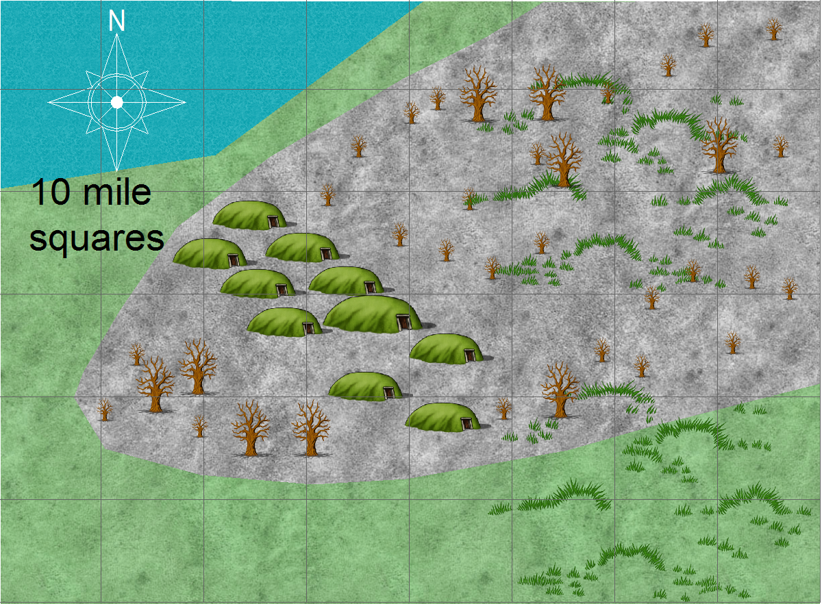
Some parts of the mud flats are safe to walk on, other parts are extremely dangerous. Both for the sinking of any heavy weight and the monsters. Note the waters around this evil castle drain into the swamp and some of the mudflats to the North.
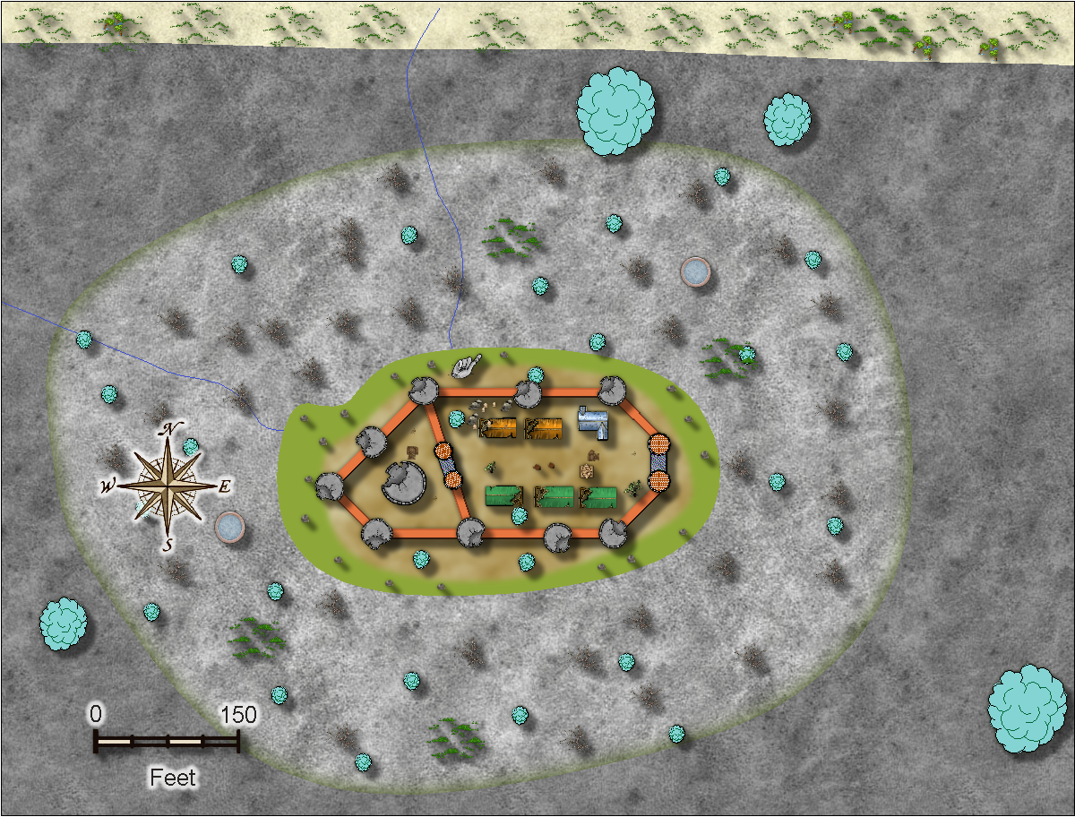
This is what the castle actually looks like.
Years ago some evil knights and magic-users lived here, they were attacked and destroyed.
Now an evil Illusionist, who dabbles in alchemy, resides here. The flickering torches used to rebuild this castle were seen by the folks in Lone. They decided it was ghost fires from the battles.
But the Illusionist is not alone. There are evil clerics, fighters, and magic-users here as henchmen and hirelings. Along with a few ‘lab assistants’.

Author
Bill George
Categories
Outer Ocean
Posted
Comments are always off.
This site is mostly about my 1980-1985 paper and pencil Advanced Dungeons and Dragons campaign. I have added maps and content since I created this blog.
We played many times. At first we only played once a week. At my peak of refereeing, I ran 5 games a week from 2 to 8 hours each in 3 different game stores with one weekly session at home.
We stopped playing in 1985/1986 as it was just taking up too much of my time.
Years later, I found web pages had been invented. I also found the mapping software, Campaign Cartographer 2.
I started small, one map a week, in 1999. Oceans, cities, towns, castles, ruins, nations. At first I scanned my old paper maps, 5mm hexagon and square grid paper. Imported the BMPs into CC2, traced over them. Added symbols and text. Saved them as CC2 fcw files and pngs. Created my website, and uploaded the files.
These days I use Campaign Cartographer 3 with add-ons. I have created a number of new maps for this web site.
I have been using CC3+ for several years now.
Author
Bill George
Categories
Crest of a Star, About